Tuesday, December 29, 2009

Best Rockshelter EVAH!

At the apex of a hill on the Chestnut Hill side of the Wissahickon Creek, you can glimpse this collection of boulders, faintly reminiscent of Burnt Hill.
When you reach the summit, the angle of the stones makes their arrangement to be, more likely than not, entirely due to natural processes, although some of the stones may have been modified slightly. In any event, once you find yourself among these stones, you see the following structure immediately adjacent to you:

There is a small platform at the base of the structure and the slope of the valley wall. Noticing this, I walked over to that platform and treated to the following site:

Probably the best cave/rock shelter I've seen along the Wissahickon. It is about 10 feet deep and well sheltered by the overhang pictured above. There is lots of evidence of many fires being built here, blacking of the surrounding stone, etc. The edges of the cave, and the several "layers" of stone visible make it possible that the mouth was progressively enlarged by hand. No evidence that anyone has ever tried to excavate. Immediately next to the main cave, is a small niche in the rock. Another rock has been placed inside the niche, almost like a sort of "shelf". It is heavy enough that I doubt it landed in there by accident.

Also, right next to the cave mouth, there is a lot of evidence of *very* well-worked stone.

Is this natural? Recent? Dunno. On the flat expanse of some of these surfaces, there are some markings.

A snowman?
Maybe someone came along and quarried some of these blocks, but that hypothesis is made problematic in that the sizes and shape of the squared off blocks is irregular, and in some areas just melts into the natural contours of the surrounding stone.

Unusual artifact

My son found this stone while we were hiking in Valley Green this summer. It is smooth to the touch, and features two holes, one on each side, neither of which perforates the stone. Some thoughts as to what it might be: a grommet-stone for starting fires, a "nutter" for cracking nuts, an unfinished fishing net weight (unlikely given the location....net-fishing in the Wissachickon won't get you much), or an incomplete amulet?


Saturday, December 26, 2009

Propped Rock: Winter Solstice Notch?

So, a few summers ago I noticed the following formation above Valley Green. Near the center of this picture, slightly offset to the left, is a line of boulders. You can see two of them here, quite clearly, capped in snow.


This larger boulder in this formation is actually a propped rock, with a long niche between the larger boulder and the rock propping it up. I snapped this picture about 15 minutes before the sun fell behind the valley walls. It is Christmas Eve, a few days after the "proper" solstice. Note that the light from the sun falling on the snow is almost aligned with the notch. I wish I had taken this picture a few minutes later. The light should fall exactly on the notch.


I walked a ways back from the formation, and up a small valley, until the two boulders in the first image were exactly in line. They mark the location of the setting sun almost precisely.


There are a lot of old stone wall remnants on the crest of the hill near this location, and also a stone "seat" carved right above this location. Very neat.

More Rock Shelter

A nice view space under the rock shelter from the earlier post, around Thanksgiving:


Immediately in front of the shelter opening, there is this propped rock, propped on a boulder, both resting on another boulder. Forms a neat little niche.


Another view:

Nearby rock on rock:

White standing stone, in a cluster of piled largish rocks. Stands immediately in front of a bluff:


Closeup of the white standing stone:

Niche in bluff behind standing stone:


Nearby shattered rock pile:


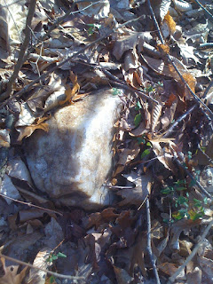
Nice chunk of quartz near pile:

Saturday, June 27, 2009

The Old Cart Road

(pics from earlier this summer)

Again, near Valley Green, at the junction of the Forbidden Drive and Wise's Mill Road, there is an old cart road that winds its way through the woods, merging with the Forbidden drive a stone's throw from the old Valley Green Inn. A brief hike up this road


and I found an interesting trio of quartz boulders, one propped up on the other two.


If you look closely behind this propped boulder, you can see a pile of smaller rocks abutting these
two boulders.


The remnants of thsi smaller pile are more visible in this shot from directly overhead.


Further along the road, slightly uphill and off it, is a very large pile of mostly largish schist rock.
If it represents dumped fieldstone from a passing cart, it was dumped *uphill*. So maybe it represents something else.

Rock Shelter near Andorra

A really neat rock shelter, overlooking a small valley near the Andorra section of Roxborough.
Lots of piles around here, mostly spread out or shattered.


What look like steps chipped into the top of the rock shelter...


One of the many piles smeared across the ground here. The rocks go pretty deep. I wonder if it is a grave?

Sunday, May 3, 2009

Odds and Ends above Valley Green.

Found lying against a large pile of rocks not far from Wise's Mill Road, right above Valley Green..


A closer view:

And a nearby pile, very long, and covered by much detritus:

A split boulder, filled to the brim with many pieces of Wissahickon schist:


And finally an interesting standing stone (next to my 5 year old son for comparison):

Saturday, March 7, 2009

Rock Markings

Not much to comment on here, but these rockmarkings are interesting. Both examples are near the "turtle formation."


Select the above picture, the enlarged version has some very clear "dots" on it. Is there a way this would happen naturally? I don't know.


There's little doubt this one is man made, though. But made by whom? And why?


If it's of any relevance,nearby was this arrangement of boulders, similar to others I've seen around here:

Friday, March 6, 2009

promised update,at last

Forgive the delay, life has kept me busy, and far from blogging. Here's some more photos from the hike that rewarded me with the previous post.

First, more of the turtle.


This large rock forms the turtle's "shell", if you pan out a bit....


Nearby I found a nicely propped rock. It had clearly been broken out of another boulder, and then dragged up, and over its source-rock, to make a niche.

Mechanically, an upright rock, with the end falling off doesn't work....as the roof rock wouldn't then be resting on the base rock. And the angle of the local bedrock is wrong for the boulder to have been broken in the other direction...


And,right at the crest of this hill, several shattered piles of small stones (or one,very large, shattered pile).

Sunday, February 15, 2009

Dream of the BlueTurtles


That does appear to be an "eyehole" bored into this boulder, behind the open "mouth".


I'll have more to say about this in a day or so.

Friday, January 2, 2009

Shaped Boulder/solstice/platform site

Hiking upstream along the flood of Wissahickon valley, starting from near the Valley Green Inn, I happened along the following outcrop on the Chestnut Hill side of the stream.

Intrigued, I followed a dry streambed up the valley wall, and found myself face to face with a fellow of truly ancient mien.


I hope I'm not the only one who sees the face in that rock. Maybe I've been looking at these things too long. I worked my way past the "face" and to the hills local maximum, and noted the following, almost "megalithic" arrangement of boulders.


The heavily slanted boulder in the right side background is part of the "face" formation above.
Today, an hour or so before the sun fell below the horizon, we're treated to the following sight:


That's a very interesting notch between the two foreground boulders, isn't it?


In between these (arranged?) boulders is a small "courtyard. It has the appearance of a "pavement" of sorts, with several arranged rocks acting as "flagstones".